
 Zakirin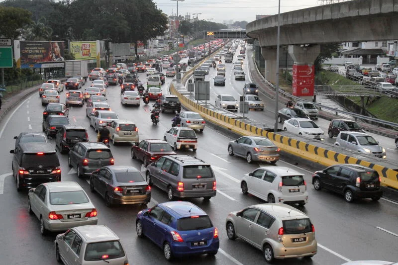
Kuala Lumpur’s rapid urban expansion continues to strain its existing road networks, prompting renewed calls from lawmakers for a moratorium on high-density developments until adequate infrastructure upgrades are actively implemented. Following Kuala Lumpur City Hall’s (DBKL) recent commitment to assess developmental capacity in the Bangsar district, Seputeh Member of Parliament Teresa Kok has formally requested a similar, comprehensive six-month study targeting the southern corridors of Bukit Jalil, Sri Petaling, and Old Klang Road. Highlighting severely congested thoroughfares, inadequate public transportation access, and the continuous approval of dense residential projects, the lawmaker has urged local and federal authorities to prioritize structural interventions before granting further development orders. Among the most prominent suggestions raised is the potential construction of an elevated, double-decker roadway along Old Klang Road, a critical arterial route that has recently recorded upwards of 200,000 vehicles per day during peak holiday seasons.
Key Points
- The Seputeh Member of Parliament is urging Kuala Lumpur City Hall to conduct a thorough six-month infrastructure capacity study for Bukit Jalil, Sri Petaling, and Old Klang Road.
- High-density projects, particularly the proposed 17,000-unit Bandar Madani development in Bukit Jalil, are facing pushback due to local anxiety over the lack of supporting road networks.
- Lawmakers have proposed a collaborative effort between local councils and the Public Works Department to construct an elevated double-decker road to alleviate Old Klang Road’s severe traffic bottlenecks.
Urban Density and Transit Shortfalls
The escalating traffic congestion across Bukit Jalil and Sri Petaling serves as a microcosm of the broader town planning challenges currently facing the Malaysian capital. Historically developed as sporting and suburban residential hubs during the lead-up to the 1998 Commonwealth Games, these areas have experienced an aggressive surge in commercial zoning and high-rise residential construction over the past two decades. However, this vertical growth has not been matched by proportionate upgrades to local road capacities or public transit integration. Industry observers note that while the broader Klang Valley is serviced by extensive light rail transit (LRT) and mass rapid transit (MRT) lines, last-mile connectivity within these specific southern suburbs remains largely inadequate, forcing the majority of residents to rely heavily on private passenger vehicles.
According to the Seputeh MP, the core of the ongoing traffic crisis lies in the continued approval of high-density housing projects in zones where the existing road network simply cannot be expanded at ground level. Despite these obvious spatial limitations, DBKL has persistently green-lit new developments, compounding the volume of daily commuters filtering onto finite arterial roads. Transport analysts frequently point out that simply adding more stage buses is insufficient if the foundational road hierarchy cannot support dedicated mass transit lanes without severely penalising regular vehicular traffic and local commercial access.
The Bandar Madani Development Concern
A major focal point of the current infrastructure debate is the proposed Bandar Madani mega-development situated in Bukit Jalil. Envisioned as a massive residential undertaking comprising approximately 17,000 housing units, the project has triggered substantial anxiety among existing residents and local stakeholders. If completed and fully occupied, a project of this magnitude could introduce tens of thousands of additional daily car journeys into a road system already operating well beyond its designed maximum capacity.
To contextualise the primary urban planning concerns surrounding this specific development and the broader southern corridor, several critical bottlenecks and policy issues have been identified by urban planners and local representatives:
- Public Transit Integration: A severe lack of covered pedestrian walkways and feeder bus reliability linking new residential plots to existing LRT Sri Petaling and MRT Putrajaya line stations.
- Spatial Constraints: The physical inability to widen existing ground-level dual carriageways in fully matured neighbourhoods without engaging in prohibitively expensive land acquisition.
- Infrastructure Lag: The common tendency for residential property handovers to occur years before the completion of promised traffic dispersal systems or highway interchanges.
- Policy Inconsistency: The continuous issuance of development orders by city officials prior to the completion of comprehensive traffic impact assessments (TIA) that reflect modern post-pandemic commuting patterns.
Lawmakers have insisted that the federal government and DBKL must execute a stringent feasibility study specifically targeting the Bandar Madani proposal. There is a growing consensus among urban planning experts that large-scale housing initiatives, while crucial for addressing urban housing shortages across the Klang Valley, must strictly align with the actual carrying capacity of local utilities and municipal transport grids.
Old Klang Road Bottlenecks and Constraints
Further north, the traffic situation along Old Klang Road (Jalan Klang Lama) presents a distinct set of legacy infrastructure challenges. As one of the oldest and most historically significant arterial routes connecting central Kuala Lumpur to the rapidly expanding suburbs of Petaling Jaya and Puchong, the road is heavily relied upon by logistics operators, daily commuters, and commercial vendors alike. Statistics cited by the Seputeh MP underscore the severity of the congestion; during the 2026 Chinese New Year festive period, daily traffic flow on this single route peaked at an overwhelming 200,000 vehicles, firmly establishing it as one of the densest transit corridors in the federal territory.
The daily gridlock on Old Klang Road is consistently exacerbated by a combination of enforcement shortfalls and structural road design failures. Unclear demarcations regarding controversial bus lanes—often leaving motorists confused as to whether they are actively enforced—reduce functional lane availability for passenger cars. Furthermore, rampant illegal parking near commercial shop lots and a high density of unsynchronised traffic light junctions severely disrupt continuous traffic flow. In multiple sections, the broad thoroughfare suddenly tapers into single or dual lanes, creating unavoidable pinch points that trap commuters for extended periods during the morning and evening rush hours.
Evaluating the Elevated Highway Proposal
In response to these compounding issues, there is a prominent push for highly visible, structural interventions rather than incremental traffic management adjustments. The most significant proposal put forward is the construction of an additional double-decker road or elevated flyover stretching along the most congested segments of Old Klang Road. By vertically stacking the carriageway, urban planners could effectively double the route’s vehicular capacity without requiring the mass land acquisition and demolition of the high-value commercial properties flanking the existing street level.
This proposed infrastructure project would require a strategic, multi-agency collaboration between DBKL and the federal Public Works Department (JKR) to ensure that piling and foundational work do not disrupt existing subterranean utilities. While no official budget has been drafted for this specific alignment, civil engineering analysts estimate that an elevated highway structure in a densely built-up urban environment could cost upwards of RM150 million to RM300 million per kilometre, factoring in utility relocation and night-time construction premiums. Similar elevated bypasses across Kuala Lumpur have successfully segregated long-distance bypass traffic from local commercial access, providing a proven template for such a project.
Currently, DBKL has committed to a six-month infrastructure review strictly for the Bangsar district, as announced by Mayor Datuk Seri Fadlun Mak Ujud on August 24. It remains to be seen if local municipal authorities and the federal government will officially expand the geographic scope of this urban study to formally include Seputeh’s congested southern corridors and evaluate the engineering viability of the proposed elevated highway structures.